3D Laser Scanning at Aigai, Vergina, Greece
Supporting Archaeological Research at a UNESCO World Heritage Site
In July 2026, the Hellenic Archaeological Exploration Society joined Ilios Remote Sensing and Norsk Remote Sensing in supporting archaeological research at the ancient city of Aigai in northern Greece.
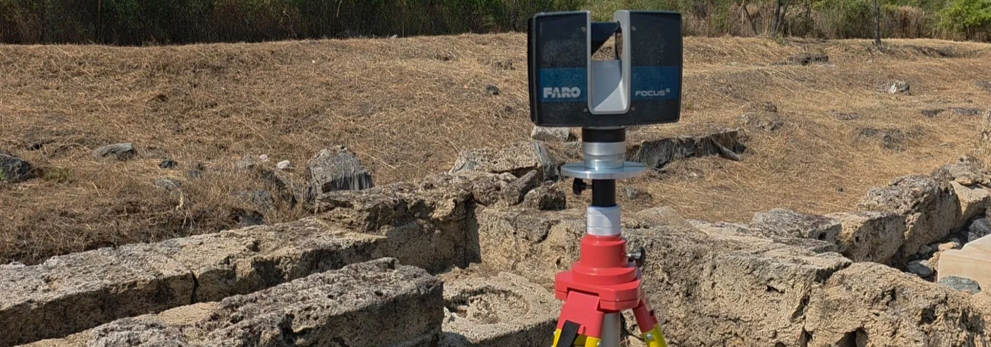
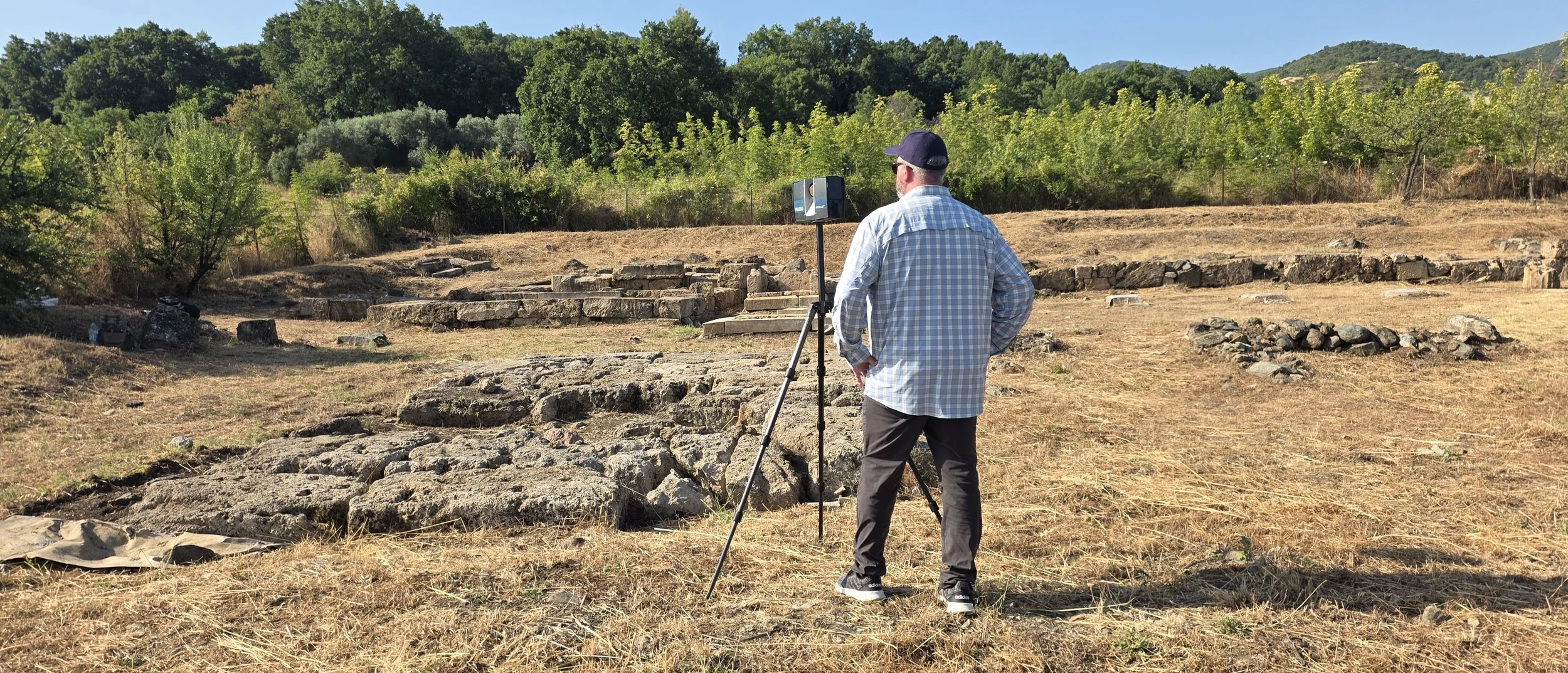
Working in support of an archaeological excavation conducted by Aristotle University of Thessaloniki, the team used terrestrial laser scanning to create detailed three-dimensional documentation of the active excavation.
Aigai was the first capital of the ancient Macedonian kingdom and is one of Greece's most important archaeological sites. The archaeological site of Aigai is inscribed on the UNESCO World Heritage List.
The project demonstrates how nonprofit organizations, universities, and industry partners can work together to bring advanced reality-capture technology directly into archaeological research.
Technology in Support of Archaeology
Documenting an Active Excavation in Three Dimensions
Archaeological excavation is inherently destructive.
As archaeologists excavate through successive layers, the site changes. Features are exposed, material is removed, and relationships that existed at one stage of the excavation may no longer be physically present at a later stage.
Three-dimensional laser scanning provides a way to create a highly detailed geometric record of the excavation at a particular moment in time.
At Aigai, terrestrial laser scanning was used to document the excavation in three dimensions, preserving the geometry and spatial relationships of archaeological features for future study.
The resulting point-cloud data can be measured, examined, compared with future surveys, and used as a digital record long after fieldwork has ended.
Excavation changes the site. Three-dimensional documentation preserves a record of what was there.
Creating a Repeatable Record
Returning to the Same Site Over Time
One of the objectives of the Aigai project is not simply to document the excavation once, but to establish a methodology that can support future documentation.
Reference points were established so that future laser-scanning campaigns can be aligned with previous datasets.
This creates the possibility of documenting the excavation at different stages and comparing those datasets over time.
As archaeological work progresses, successive three-dimensional records can help preserve a digital chronology of the excavation and provide researchers with measurable information about features that may later be altered, covered, removed, or further excavated.
Instead of documenting only where the excavation ends, we can help preserve a record of how it developed.
Collaboration
Archaeologists Define the Research. Technology Supports It.
The archaeological research at Aigai is conducted by Aristotle University of Thessaloniki.
HAES and its industry partners support that research by providing specialized technology, equipment, technical expertise, data acquisition, and processing.
This distinction is important.
Our role is not to conduct archaeology independently. Our role is to place advanced technical capabilities in the hands of the archaeologists and institutions responsible for the research.
The archaeologists determine what questions need to be answered. Our job is to help provide tools capable of collecting useful information.
Industry Partners Supporting Research
Ilios Remote Sensing & Norsk Remote Sensing
The Aigai project demonstrates the model HAES was created to facilitate. Commercial reality-capture companies possess specialized equipment and expertise that can be expensive for universities, museums, archaeological organizations, and nonprofit institutions to maintain internally. Through collaboration, those capabilities can be made available to research and cultural-heritage projects.
Ilios Remote Sensing provided terrestrial laser-scanning equipment, fieldwork, and reality-capture support. Norsk Remote Sensing contributed additional laser-scanning expertise and experience in cultural-heritage documentation.
For Norsk Remote Sensing's Jerry Dawson, Aigai represents his second UNESCO World Heritage Site documentation project, following previous work at Qal'at al-Bahrain (Bahrain Fort).
Industry provides the technology. Researchers determine how it can best serve the archaeology.

Teaching the Next Generation
Technology Transfer Is Part of the Mission
The project was not limited to collecting data. The team also introduced participating university students to terrestrial laser scanning and its applications in archaeology.
Giving future archaeologists exposure to modern reality-capture technologies helps them understand both what these tools can accomplish and when they are appropriate to use. This is central to the HAES mission.
Our objective is not simply to bring technology to an archaeological site. It is to help make that technology accessible to the researchers and students who will use it in the future.
From Aigai to the Seafloor
Extending the Same Philosophy Underwater
The experience gained through terrestrial archaeological documentation also informs HAES's work in underwater archaeology.
Through Project eNiGMA — Next Generation Maritime Archaeology — HAES and its technical partners are working to extend advanced reality-capture and remote-sensing capabilities into underwater archaeological research.
The environments and technologies are different, but the principle is the same:
Archaeologists define the questions. Technology helps provide the answers.
Supporting Archaeology Through Collaboration
The Aigai project demonstrates what HAES seeks to accomplish: bring universities, researchers, nonprofit organizations, technical specialists, and industry together in support of archaeological research and cultural-heritage preservation.
Specialized technology does not need to remain limited to organizations with large equipment budgets.
Through collaboration, expertise and equipment developed in the commercial world can be applied to research, education, documentation, preservation, and public outreach.
When the right people, technology, and research come together, everyone benefits—and the archaeological record becomes richer for it.