
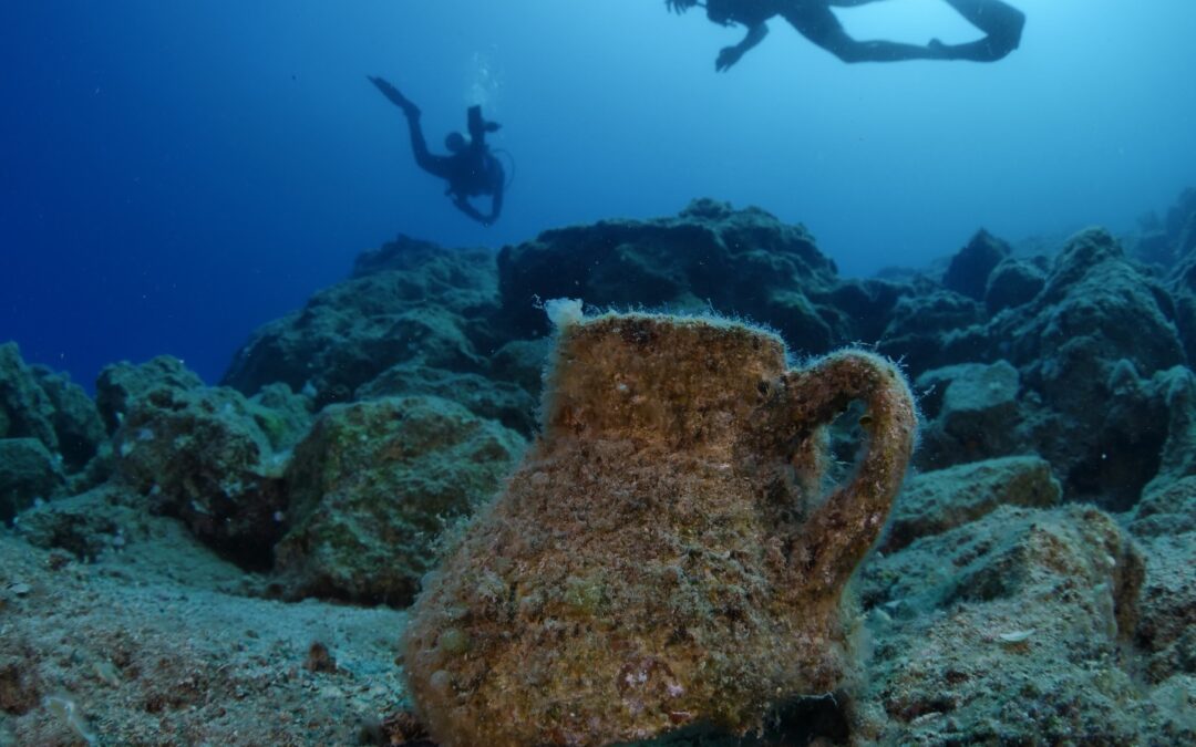
Underwater archaeology has evolved considerably over its short history with its beginnings in the mid-twentieth century. Initially, tape measures, depth gauges, and hand sketching were used for surveying a site.

Photo credit: Viv Hamilton
While underwater photography began in 1856, it wasn’t until Jacques Yves Cousteau and Jean de Wouters released the Calypso, a 35 mm film camera, in 1957 that a practical camera for underwater research. But it took time for underwater photography to be commonly used by underwater archaeologists.
#/media/File:Calypso_camera.JPG)
Photo credit: Jan von Erpecom
Photogammetry, the generation of 3D models generated on a computer using many digital images and video, was a leap forward in underwater archaeological fieldwork. Computer-generated 3D point clouds assisted in studying a site from a desktop. Unfortunately, these models do not have anywhere near the accuracy of laser scanning, but digital photography was certainly a leap forward in the tools available to underwater archaeologists.
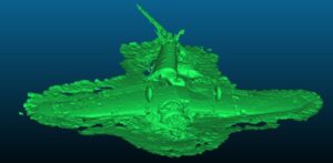
Photogammetry model credit: Kees Levernz
Side scanning sonar was added as a tool for located underwater sites in the mid-1960s. This tool is able to detect potential sites over a large area and will aways be a tool used by scientists. During a marine geology expedition led by Dr. Ferentinos and Dr. Papatheodorou of the University of Patras in 2013, a Roman merchant shipwreck was discovered using high-resolution side-scanning sonar survey. Side-scanning sonar will always remain an invaluable tool for site discovery and validation.
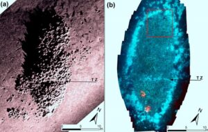
Side scanning sonar images credits: Ferentinos et al
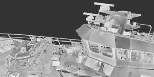
Until today, underwater laser scanning was limited primarily to the oil & gas and nuclear power industries. Laser scanners were mounted to submarines which provided both a stable platform and positioning information combined with the laser scanning data to create 3D point clouds.
![]()
Nuclear power plant laser scanning, credit: Newton Labs
The use of submarines required the use of large research vessels which require an additional crew, are expensive to maintain. This made the adoption of laser scanning for underwater archaeology impractical from a logistical and financial sense. It simply required a budget too large for universities and research institutions.
Today, subsea laser scanning is in reach for the university researcher. The VideoRay Mission Specialist Defender ROV (remotely operated vehicle) provides a sufficiently stable platform for laser scanning. With the addition of a GPS for acquisition of the exact location of the ROV prior to submersing and a navigation unit like the SonarDyne SprintNav Mini navigation unit that detects the change in position, a topside computer running EIVA Mobula Ray software connected to the GPS and navigation unit on one fiber gigabit ethernet cable and to the Newton Labs PL3200UW-LW laser scanner via a separate fiber gigabit ethernet cable, EIVA software is able to consolidate position and scan data to produce high-detail 3D point clouds previously unavailable to researchers
.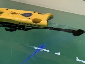
ROV and laser scanner, credit EIVA
The future of underwater archaeology is in the use of automated and programmed machines. Utilizing software from EIVA, an ROV can be programmed to scan a specified area, depth, and speed. As there may be currents, computer software is able to compensate far more accurately and quickly than an expert ROV operator.
This equipment configuration provides underwater researchers a cost-effective and logistically practical solution for creating 3D digital copies of a site with submillimeter accuracy. In terms of logistics, a Greek fishing boat is sufficiently large enough for two archaeologists and all equipment. The cost of this package less than $400,000 USD, a one-time cost that is easily covered by university patrons.

This package makes underwater research safer and more efficient, providing maritime archaeologists the tools to expand their research horizons towards new fields of survey and facilitate the management of underwater cultural heritage on various levels.
- Reducing of risk to divers, as machine automated data acquisition eliminates their need. Only site preparation and restoration might involve divers.
- 3D models provide data that can be studied on a desktop environment instead of underwater. Studying the digital model of a wreck has significant impact on underwater scientific work hours. That means that the dive team can have less dives for a certain task. This time can then be applied to additional sites, increasing the throughput of data acquisition by several orders of magnitude.
- Provides the mean to acquire data from sites too deep for divers, yielding previously unable information.
- Digital models are part of the dissemination process, where cultural, technology, and communication experts can create extended reality applications that will provide access to the remote or deep underwater sites to the wider public that otherwise will never witness them.
- Enables the creation of protection strategies monitoring sites regularly and acquiring comparison data.
While all of the above is possible with existing technology, the prevention of its adoption has always been logistics and costs. This system has the same capabilities of what only much more expensive and larger equipment provided in the past.
In a meeting in November 2020 with former senior archaeologist of the Ephorate of Underwater Antiquities, Dr. George Koutsouflakis, and now professor of History, Archeology and Social Anthropology at the University of Thessaly, said:
“An archaeologist is lucky to study one shipwreck in his or her career.’
Our goal after the expedition is to raise funds to donate this system to Dr. Koutsouflakis’ department so that all PhD candidates in maritime archaeology have their own shipwreck for their dissertations. We will collaborate with other universities and institutions as well for fundraising. The adoption of this technology dramatically reduces the time required to study a shipwreck and makes studying deeper shipwrecks possible, thus this is the dawn of a new age in maritime archaeology. The rate at which information will be generated will be revolutionary. We hope that all universities worldwide will be able to adopt this technology. Please support this effort with a donation today. Thank you.
3D Point Cloud Credit: Norsk Remote Sensing